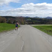
Hartford Town Forest/Hurricane Forest Wildlife Refuge, Hartford VT
By: Jennifer Hansen
Trail: HartfordTown Forest/Hurricane Forest Wildlife Refuge, Hartford VT
Map/Directions: Link Here
Percentage Runnable: 100%
Elevation Change: Lots of ups and downs
Distance: I was introduced to this system via local trail races and decided to explore further on my own. It's a small system that's easy to get to know. I enjoy parking near the dry Wright Reservoir and running several connected loops - Pond to Creek to Beacon to Tower Trail, to WB Brown, to Moose Brook, to Simonds Way, Up Pine Drop, back down WB Brown all the way down to Beacon and back around Pond. It's about 5 miles total with lots of elevation change so it's a good fast workout. I run the loops going the other way for variety.
Ease of Navigation: All of the official trails are very well-marked with signs and a different color of blaze on each loop of the system in the town forest side.
Parking: As shown on map: on Wright Reservoice Rd. across from UVAC or on Reservoir Rd.
Extra: There are dozens of trails branching off with white, diamond-shaped, hand-painted numbers; someone has obviously catalogued the system extensively. It seems possible to explore any of these as an out-and-back if you want to go further. I am curious about whether these are mapped and how far out they go.
If you want to combine your run with some bouldering, just down the road from the Wright Reservoir parking area are some pretty rocks (below).


