January 2021
By: Jennifer Hansen
This month's piece is longer than usual. Even before Coach Tim issued his Chain Run Challenge, I had been doing such a project, which conveniently finished in late November, just in time for me to add it to this month's newsletter.
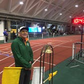
We are very fortunate to live in an area through which the Appalachian Trail passes, and some folks already use parts of it frequently for trail runs. Much of it works well for trail runs, since it's very well-marked, with many long, rolling spans, devoid of excessive rocks and roots, especially on the Vermont side. But the NH side also has many long, rolling segments which are very runnable. I had hiked all of the larger mountains on the route on hikes at one time or another, but I was very interested in finding out what was in between. I tried it out one day, running from Hanover Center Rd to the top of Moose Mountain, a pleasantly rolling, almost 100% runnable 10 mile round trip, and I was hooked. I decided to start from my home (conveniently situated 0.2 mi from the southern terminus of the Boston Lot/Landmark tract-which connects with Mink Brook trails and thus into Hanover), and run segments north along the Trail to Mt Moosilauke. Once I finished that, I decided to keep going; I started in Norwich and ran segments south to Killington Peak.
My project was completed in 14 trips over a period of from 8/14 to 11/24, so I doubled up some weeks and took others off. I say "completed," but I have so far avoided the road segment from Chase Fields in Hanover to the top of Elm Street in Norwich, and I missed about 2 miles along the Moose Mtn ridge in Hanover. The chain isn't officially complete. But I can go back and do those little bits when I have time, if I want. My shortest day, as I was pressed for time, was the 6 mile RT segment from Quinttown Rd in Orford to the summit of Mt Cube. The longest day was the 23.8-mile out and back from Vt 12 to Stony Brook in Bridgewater, made more challenging because I ran the 8.8 mi roundtrip from Pomfret Rd to Vt 12 the day before. The longer the day, the more I gave myself permission to hike the uphill portions. I ran almost all the downhills, except the snowy descent of Moosilauke along the Glencliff portion of the Trail. Since I traveled alone the whole time, all of my segments were out-and-back; essentially, I ran this part of the AT twice, once going north, once south. My total mileage on the AT was 191 miles, and since the distance from Killington to Moosilauke on the AT is about 100 miles, the Hanover/Norwich road segment and Moose Mtn Ridge miles account for the discrepancy.
To find where to park, I made extensive use of the very helpful Appalachian Trail Parking/Access website. It shows all of the places to park for section hiking, and a separate page shows pictures and gives more useful information. I contacted the Rohlands for permission and they encouraged me to let you know about the site. They replied, "We’d really appreciate a link to our website. Getting the word out about our website is the hardest part of our job." So share it with your friends!
After I was done, I purchased 2 sets of AT maps from the Appalachian Trail Conservancy. I got by, just using the Rolhands' site, Google Maps, and occasionally AllTrails, but I missed a little bit, such as now I know that Moose Mountain has a north and south summit. Mileages and elevation changes are clearly shown. I now own maps which cover the trail from its northern terminus in Maine to the Massachusetts border. Because, who knows? 2021 might give me some time to travel further north and/or south on the trail.
I have enjoyed hitting the high points in NH and VT - all the 4000 footers and other prominence peaks. But after running "our" AT, I see how it all fits together. I have felt in my body the difference between Vermont and NH terrain, I have discovered a number of lovely segments that are just fun to run on, and I've experienced this in all sorts of weather. It happened to snow on the days before I ran to the northern and southern terminuses of my project, and yet there was also that 70 degree week near the beginning of November that had me sweating in shorts and t-shirt. Also, it was interesting to explore the limits-- finding out how long of a run I would still enjoy, and how my body would handle really long trail runs. I seem to like long runs of 16-20 miles best, and only going that long once a week, with other shorter trail runs in between times. I found that packing enough food was really important. I always carried sufficient water in my Nathan hydration backpack, and found that one Builder's Bar, one Clif Blox sleeve, a small ziploc of almonds or peanuts, some sliced pepperoni and cheese, and then candy or a couple of cookies gave me enough nutrition and a diversion/treat every couple of hours. We all like different trail running shoes, I think, but I continue to be VERY happy with my Altras. I'm on my 4th or 5th pair.
If you're interested to see exactly what I did each day, and even to see mostly selfies (sorry!) over the varied weather, terrain and colors of the fall, you can view my spreadsheet here. I don't mind if no one else wants to see it. I found that planning, executing and tracking all these runs was very interesting and challenging, and the spreadsheet is a nice reminder of my 2020 AT project.